Wednesday, October 7, 2015

The Wreck of the HMCS Galiano

Published in the North Island Gazette October 14/15.
As October storms wreak their fury on the coast, some may remember the story of one particularly fierce storm almost a hundred years ago, that took the lives of 40 people in the only sinking of a Canadian naval vessel during the Great War.
Her Majesty's Canadian Ship (HMCS) Galiano, was built in 1913 in Ireland as a Fisheries Service vessel.  It was a sister ship to the HMCS Malaspina.  She was 162.3 feet in length with a beam of 27.1 feet.
HMCS Galiano (BC Archives photo)
After sailing around Cape Horn to arrive in Victoria the Galiano had only a short life in the Fisheries Service before the ship and its crew were re-assigned to the Canadian Navy and Naval Reserves when the war broke out in 1914.
The Galiano was not supposed to be north of Vancouver Island that October evening in 1918, but the Malaspina was in need of repairs and was confined to the dock at Esquimalt, so the Galiano was tasked to bring much needed supplies in to the lighthouse and wireless station at Triangle Island.  The station was apparently running dangerously low on fuel.
As the ship was taking on coal in Ladysmith a number of her crew came down with the Spanish Influenza, and a number of new sailors and officers had to be taken on from other vessels to make up her normal complement of about 40.
As a result, a number of the crew taking the ship to Triangle were from other vessels, some only boarding at the last minute.
As the Galiano set off North of Vancouver Island, it was clear that the weather was not going to be good.  In what has been described as a raging hurricane, the ship set off as the weather was reported to be 110 knot winds with 45 foot seas.
In addition to supplies, the ship was bringing a new housekeeper to replace Emily Brunton, who had been working at the wireless station and had not left Triangle Island for the last 18 months.
 Doug Bate and Arthur Hume on the Galiano.  Both men, from New Westminster, perished when the ship was lost.
The Galiano managed to make it to Triangle Island, and tucked into the East anchorage while the supplies were unloaded and the passengers embarked and disembarked via tender. When the winds started to pick up the crew quickly offloaded the last of the supplies they were carrying at the bottom of the tramway system and hurried back to the ship. They departed approximately 5:00pm.
One wireless operator, Syd Elliot, had been on the beach prepared to leave with the ship, but at the last minute he received new orders and stayed on the Island.
The night shift was on duty in the radio room at 3:00am when the mayday call came in on the wireless from the Galiano: "Holds full of water; send help."
Ironically, the ship operator who sent the message, MJ Neary, had a brother who was a wireless operator at Triangle Island, MC Neary.  Originally the papers reported that he was the one who received the message, but it was later clarified that he was off-shift, sleeping at the time. The crew opted not to wake him to give him the news.
Authorities at the time estimated that if the ship were travelling at 10 knots they would almost have been within sight of the light of Cape St. James, at the southern point of Haida Gwaii, when the distress call was made.
All vessels within the vicinity were asked to search for the disabled vessel.  The next day, in stormy seas, one body was recovered along with a skylight (15 ft by 10 ft) from the Galiano's engine room.
Within the next couple of days two more bodies were found.  It was believed that the ship either foundered on rocks south of Cape St. James or turned offshore to await the dawn and was overtaken when a large wave washed over the ship, flooding it.
The rest of the wreck was never recovered. Forty lives were lost, and the Galiano became the only Canadian naval ship to sink during World War I.  There is memorial to the crew in the Ross Bay cemetery in Victoria.


"Search Raging Seas for Missing Galiano" in The Daily Colonist (Victoria), October 31, 1918. http://archive.org/stream/dailycolonist60y283uvic#page/n0/mode/1up
http://www.nauticapedia.ca/Articles/Rybak_Galiano_Wreck.php
http://www.oocities.org/gjesperson/galiano2.html

Friday, July 24, 2015

No. 10 Radio Unit at Cape Scott during WWII


Cape Scott is located on the north-western tip of Vancouver Island.  In the 1700s it was home to the Nakomgilisala Tribes, and in the 1800s the First Nations people in the area were collectively known as the Nahwitti, their populations much decimated by war and disease.
When most people think about Cape Scott, their minds will turn either to the present day park or the early Danish settlers who took pre-emptions in the area in the late 1800s/ early 1900s.
The Cape is of interest for other reasons of historical significance, one of which is the fact that it was home to a radar base (then known as a Radio Unit) in the 1940s.
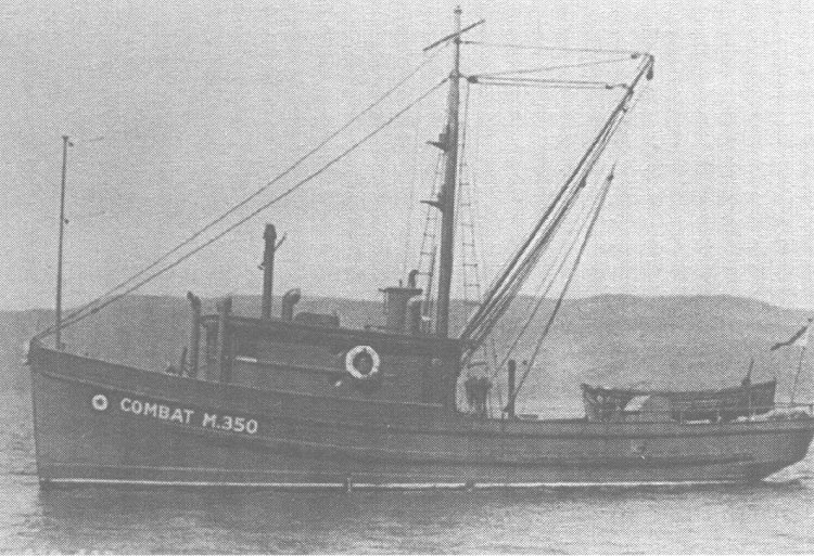
One of the vessels used to supply the Radio Unit.
During the World War II there was a great deal of anxiety about a possible Japanese attack or invasion on Vancouver Island.  In July 1942 the Canadian military started construction on a base at the head of Cape Scott which was to serve as an early warning radar base looking for Japanese aircraft.  The station became operational on February 5,1943.
Military crews were sent to Port Hardy by steamship and then boarded a smaller vessel, usually the Combat (30 ft.), the Sekani (locally referred to as the ‘Sick Annie’), or the Haida, to travel around the north part of the Island.  These ships would anchor off-shore of Cape Scott and a skiff would be used to transport people and material onto the beach.  In bad weather the dory crew would wear wetsuits for the launch.  It wasn’t unusual for the skiff to tip over and for the passengers, mail, etc. to end up in the water.  Supplies were usually brought to shore by a barge which was hooked up to a tractor which would pull it in to the beach.  At times supplies and various pieces of military equipment were swept out to sea as the crew attempted to unload them in stormy weather.

The Radio Unit Building at the Cape.

The No. 10 Radio Unit at Cape Scott worked in cooperation with other units at Ferrier Point to the south, and Cape St. James and Spider Island to the North to provide continuous protection of Canada’s coast.  The radar unit was located at Cape Scott proper, near the current lighthouse, and the crew barracks were two miles inland, just inside the peninsula.  They were connected by a wooden plank road.
Close up of one of the Radio Unit Buildings.
The base was considered top secret.  The crew building the base used trees in the area to string their antennas.  The station included six crew barracks, sick bay, canteen(which doubled as a movie theatre), mess hall, the operations centre, washrooms, and a series of plank roads.  About 50 men were stationed at the base.  Each shift would have a separate barracks, so as not to disturb each other when some were working the night shift.
There were limited recreational opportunities in the camp.  At times the crew would walk the old corduroy road toward Holberg to attend dances.
Crew men in the living area.
The military sent in movies regularly, and they arrived with the mail. At times, when the supply ship couldn’t make it to shore, there was no new movie.  This was very distressing to the men who really looked forward to their movie nights and didn't like having to watch the same movie multiple times!
For recreation, the men tried swimming (too cold) and played ping pong. They cleared a volleyball court and would split into teams and have tournaments.  The group also set up a softball diamond. If the weather was good sometimes a team from the Port Hardy air force base would come and challenge the Cape Scott crew to a game.
The No. 10 Radio Unit was notoriously difficult to get to due to the weather and seas.  Many soldiers arrived without a lot of experience on the coast and wondered what they had gotten themselves into!
Crew men at Guise Bay.
At times, when ships couldn't get access the base, the military would use planes and would drop supplies in by parachute.
Crews on the station were mainly responsible for watching the radar for possible enemy invasions.  They didn't see a lot of action, although on more than one occasion a flock of geese was mistaken for a convoy of enemy Japanese planes.  They both flew in a similar formation!
One airman stationed at the beach said the crew were all surprised one day when a cow was delivered along with the normal rations.  No one at the base knew how to take care of the cow.  Then, one day the cow had a calf and certainly no one knew how to look after a calf, so the station's cook decided to make veal.  Unfortunately the cow was so distressed that she ran away and the crew were unable to find her.
In January of 1944 one diary from the site noted that it had rained so hard that the plank road was floating in places.
Plank road which connected the Radio Unit operations and the living areas.
The air men had to be quite self-sufficient, cutting wood for the boilers and cleaning their own clothes. The men also wrote a regular camp bulletin for their amusement called “The Isolationist."
The base was eventually decommissioned, after the surrender of Japan, in September 19,1945.

Thanks to John Coldwell For the photos from his Lighthouse Memories website and to the Pinetree Line website (the author, Ren L'Ecuyer passed away in 2005, but he did an amazing job amassing a wealth of information).

Thursday, June 25, 2015

Robert (Bob) Scott - A Friend to the North Island

Published in the North Island Gazette June 25, 2015.
Anyone who has lived in Port Hardy in the last 50 years will be familiar with the name Robert Scott. It has been prominently displayed on the former elementary school building anchoring one end of Market Street in downtown Port Hardy.
Most people who pass this building have no idea who Robert Scott was, or his significance to the North Island.
Robert Modal Scott was born in England around 1905. He dropped out of school at 15 years of age to start working.
In 1927 Scott emigrated to Canada, and for the first couple of years in his new country he worked in general stores on the Prairies.
In 1937 he moved to the coast, and worked in a store in Quathiaski Cove, on Quadra Island, for BC Packers.  There he met his wife Eileen. Eileen was born in New Westminister but grew up in Ocean Falls until her family moved to the Cove.
During this period Scott took it upon himself to learn Chinook, a trading language used by First Nations along the coast.
In 1938 he moved to Alert Bay, again to work for BC Packers.
He used his savings to buy "Smith's General Store" in Port Hardy in 1945 from Silas Pugh.  He changed the name to "Scott's General Store."  With the development of the Air Force Base (at the airport) during World War II, Bob Scott (as he was locally known) believed that it was only a matter of time until large scale development came to Port Hardy.
Robert "Bob" Scott

Scott built Port Hardy's first power plant with Buster Cadwallader, and was the first to bring electricity and refrigeration to a local store.
He eventually expanded to separate his grocery and hardware stores.  When Dong Chong built a larger grocery store in Port Hardy, Scott sold out his grocery and concentrated on his hardware interests.
Scott was the proud holder of account #1 from the first bank in Port Hardy, the Bank of Nova Scotia.
Although he was an entrepreneur, it was not Scott's business interests that endeared him to the communities on the North Island. He was a member of the local medical board, the Port Hardy Chamber of Commerce, the inaugural Port Hardy Parks Board, and the District Recreation Committee.  He was also a member of the Masons.
When Scott became a member of the School Board, there were two separate Boards for the Quatsino and Alert Bay school districts.  He played an important role in amalgamating the Boards and reducing duplication.
Scott took it upon himself to lobby the BC government for more funding for North Island schools. When Education Minister Bill Straith was travelling through Port Hardy on his way to Prince Rupert, Scott took him on a tour of Port Hardy's small two room schoolhouse to show him the need for better facilities.  The result was that the Board secured $500,000 for each of two new elementary schools in Port Hardy and Port Alice.
One of these schools, Robert Scott School, opened in the spring of 1954.  The original school fell victim to an arsonist in 1974 and was rebuilt on the same site.
The response wasn't all positive though, and Scott had to make some controversial decisions.  As a Port Hardy resident he heard a lot of complaining about the decision to build one high school, North Island Secondary School, in Port McNeill, but he believed it was the right location to support the tri-port area as well as Alert Bay, Sointula, and other outlying communities.
Scott is also remembered as being instrumental in securing the right for First Nations children to attend public school on the North Island.  He was honoured with the title "Giykumi" (Chief) by the Kwakiutl First Nation.
Scott was a school board trustee on the North Island for thirty years.
Interested in local history, Scott personally helped to finance a history book about Port Hardy called "A Whale of a Story." Sales of the book supported the local hospital fund.
In 1973 he retired, looking forward to a quiet life at Storey's Beach.
In October 1974 he travelled on holiday to Toronto to meet with his sister from Scotland.  He choked on his food while dining out at a restaurant.  He was rushed to the hospital but fell into a coma.  He was transferred to St. Paul's Hospital in Vancouver but sadly passed away November 14, 1974.

"Scott, Robert and Eileen" in A Dream Come True: Port Hardy 1904-2004. p. 193
"Pioneer Merchant Passes Away" North Island Gazette. November 21, 1974. p.6.
"Trustee Resigns after 30 years" in North Island Gazette. October 4, 1973. p. 10.

Sunday, May 24, 2015

The Wreck of the Great Northern No. 5

Published in the North Island Gazette  June 4, 2015.
The upcoming television show Alone, filmed in Quatsino Sound, is reminiscent of a real life survivor event that happened in 1939.
In December of that year a fish packer called the Great Northern No. 5 was travelling in the area off Estevan Point, just North of Clayquot Sound, when it was disabled in a storm.  The packer dropped its skiff, and then without a radio to make a mayday call, drifted north for two days.
The ship's engineer, Ted Barnard, was swept overboard and perished, and the boat was smashed to pieces.
The remaining two sailors, Captain George W. Skinner and his son Hugh Skinner, managed to stay afloat clinging to pieces of the cabin of the ship.
This photo is reportedly the original Great Northern No. 5.  In the 1950s a new Great Northern No. 5 was built and fished until about the year 2000.  Photo Bob Koskela.

Father and son finally washed onto the rocky beach in the area around Lawn Point.  Unfortunately a search which had been launched focused on the area south of Brooks Peninsula. 
George Skinner was weak and injured, and Hugh stayed with him for two days trying to find food and to make a simple shelter.  Eventually Hugh decided to try to get back to civilization, and set out hiking the beach in a northerly direction, leaving his father lying in the brush near the beach.
Hugh hiked for five days before he was finally spotted by a Ginger Coote Airways plane which was a part of the search for the missing Great Northern No. 5 that had been expanded to include Quatsino Sound.
The float plane was unable to pick up Hugh, but did land in Winter Harbour, where a fisherman agreed to take his boat out to pick up the lost sailor.  After he was rescued he was flown to the hospital and eventually transported to Vancouver, where he had to have two toes amputated.
When Hugh was located he told the searchers where he had left his father, and searchers enlisted the help of a number of trapper/guides to scour the shoreline.  Unfortunately the weather at the mouth of Quatsino Sound was too rough for the searchers to be taken to the location by boat, and they had to hike into the area.  It took them three days just to get the spot where Hugh had been found.
On January 4, 1940, twenty one days after Hugh had left him lying in the bush, George Skinner was found by the searchers.  He was barely alive, and had lost a significant amount of weight.  He had survived by sucking water from moss within reach of the spot where he lay.  It had rained every day of his ordeal.
The searchers sent up a signal and a plane dropped supplies for the victim and his rescuers.  It was three more days before the weather calmed down enough for a boat to get in to rescue them from the secluded beach.  George was immediately taken to the hospital in Port Alice via a sister ship to his own, the Great Northern No. 1, owned by the Francis Millerd and Company, and then transferred to Vancouver suffering from "exposure, starvation, and contusions generally."
 Photo from West Coast Fisherman.
Captain Skinner was reportedly transferred from Winter Harbour to Port Alice on the Great Northern No. 1.
Corporal Howe of Alert Bay, Constable Winegarden of Zeballos, and Constable Lockwood of Port Alice all received commendations for their role in rescuing the lost men. In part, the commendation read: "Hampered by winter gales, and working on an extremely dangerous coast, the efforts of Corporal Howe and Constables Winegarden and Lockwood were worthy of the best traditions of the Force."
Both George and Hugh Skinner returned to the fishing industry, and fished along the coast for many years.

Sources:
BC Police files - 1940: http://nbca.library.unbc.ca/files/2013/10/General-Orders-Nos.-247-283-Severed-1940-1942.pdf
Nicolson, George.  Vancouver Island's West Coast: 1762-1962. Morriss Printing Co. Ltd. p. 261-263.
"Marooned Captain Taken to Hospital: George Skinner rescued after three weeks exposure on Vancouver Island." Montreal Gazette, January 8, 1940. p. 3. https://news.google.com/newspapers?nid=1946&dat=19400108&id=KH8uAAAAIBAJ&sjid=75gFAAAAIBAJ&pg=2438,1062502&hl=en 

Thursday, May 21, 2015

Writing about local history in a place where it is still very much alive...

I'm going to deviate from my normal history columns to say a quick word about my home on Northern Vancouver Island for those of you who may stumble upon this blog because you were searching out some information on a place to go camping or fishing.
When I first moved to the North Island in 2001 I was interested in local history and, apart from a couple of books which referenced Cape Scott (but were out of print), Sointula, or family history stories from Port Hardy, I found there was very little accessible information.
The more I looked into the history, the more fascinated I became.  
The first European settlement was on the North Island's West Coast, at Friendly Cove, and that small settlement almost caused a war between Spain and England.
When trading started in earnest the power and ceremony of North Island First Nations was legendary, and led to federal policies in Canada which banned one of the most prolific cultural practices by local First Nations, the potlatch.
When Europeans arrived on Vancouver Island, they first traded by ship in areas like Shushartie Bay.  Fort Rupert, in the greater Port Hardy area, is the second longest settlement of Europeans on Vancouver Island, behind only Fort Victoria.
Many of the families who live on the North Island today can count local First Nations and early settlers to the area as their relatives.  It has been overwhelming to see how many North Island families alone have descended from the Hunt family, who purchased Fort Rupert when it was divested by the Hudson's Bay Company.
As an amateur historian, cobbling together information from a variety of sources (government records, articles, books, personal interviews, archives, etc,) to tell the history of this area is a humbling experience, when to many of my neighbours the history of the North Island is their story.
Publishing an article in the North Island Gazette, preparing a presentation for the local museum, or chatting with an old timer have always worried me.  I don't want to get something wrong and misrepresent this area and its people. 
I am gratified to say, that after more then ten years of information collecting, muddling through, and voracious reading, I am still gratified every time a local old-timer approaches me in the Post Office and thanks me for a recent article.
I am so pleased to live on the North Island and to have the honour of the trust of local people to help collect information about the truly incredible history of this amazing place.

Wednesday, April 22, 2015

Western Whaling Company in Coal Harbour

Published (in part) in the North Island Gazette May 7, 2015.
In the mid-1800s the whaling industry was in its heyday on the Pacific Coast, until the lucrative right whales were hunted almost to extinction. It is estimated that the Northern Pacific right whale catches between 1840 and 1849 could have been as high as 30,000 individuals. As the availability of these cetaceans declined the fleet turned to the more lucrative fur seal harvest for a number of years.
Many BC First Nations people were recruited to work on whaling vessels, which would travel all over the Pacific Ocean. Some early settlers were surprised to enter a First Nations' big house in Quatsino in the mid-1800s to find First Nations women wearing traditional kimonos. These had been obtained through men working on whaling ships which visited Japan.
In the early part of the 20th century there was a revival of interest in whaling. Whaling stations were built along the BC coast at Sechart (Port Alberni), Cachalot (Kyoquot), Naden Harbour (Haida Gwaii), and Rose Harbour (Haida Gwaii). The whaling industry existed largely to provide oil and fertilizer, and was heavily reliant on Norwegian expertise. A recession, coupled with a glut of whale oil on the international market, resulted in the closure of most BC whaling stations in the early 1920s.
With the advent of World War II, and the internment of Japanese Canadians, the BC whaling industry lost much of its shore-based labour force. Production came to a halt for a few years and faced significant restructuring. The prohibition on civilians using marine radios during the war years also made it difficult, if not impossible, to carry out whaling on the Pacific Coast.
In 1948 a new "Canadian-owned" whaling corporation was formed: the Western Whaling Company.
Initially the consortium intended to retrofit the old Rose Harbour Whaling Station on Haida Gwaii, but about this time the Canadian government divested a seaplane base it had constructed for WWII in Coal Harbour, Quatsino Sound.
The site had two large hangars with big bay doors, docks, accommodation, and a sloped ramp for loading sea planes in and out of the water. The Western Whaling Company snapped up the site and fitted it with digesters, cookers, a meat press, separators, an evaporator and freezer plant.
The largest disadvantage of the site was its distance from the whaling grounds, but an arrangement was made to have harvest vessels tow their whales into Winter Harbour, where transport vessels could pick them up and tow them in to the Coal Harbour processing facility.
Compared to earlier whaling efforts, this era saw larger boats, improved technology (including the use of airplanes to find whales), and a longer hunting season.
In its first season, 1948, the station processed 182 whales. The main products were oil and tinned meat, which was in high demand during the war. The next year production increased to 250 whales.


Coal Harbour Whaling Station in the 1950s.
In 1951 the whaling station processed the last right whale which was seen in BC waters for many decades. Only within the last two years have right whales again been spotted in BC. The Northern Pacific right whale is now considered the rarest large cetacean, and it is possible that the population declined to less than 100 individuals. It is now listed as endangered under Canada's Species at Risk Act.
By the late 1950s the market for whale meat had dropped off, and while some whale meat was sold to Asia for human consumption, much of the product was sold to mink ranchers or for fertilizer. The catches were also increasing, putting higher amounts of product onto the market. 
The single year with the highest production of whales at Coal Harbour Station was 1964, with 880 animals killed.
Some archival video of work at the station is available on youtube: https://www.youtube.com/watch?v=9ick1H-KTfk (caution - the images may be disturbing to some people).
The whaling station was permanantly closed in 1967 and since 1972 most commercial whaling (with a couple of exceptions) has been banned in Canadian waters.


Tuesday, March 31, 2015

Exploring the "Uncharted" areas of Vancouver Island

Published in the North Island Gazette April 16, 2015.
In the mid 1800s, most of the Europeans who had settled on Vancouver Island lived at Fort Rupert (by modern day Port Hardy) or Fort Victoria. Most of Vancouver Island was still viewed as a vast, uncharted wilderness.


Smallpox and other European epidemics had taken a heavy toll on the First Nation population of the Island (the major outbreak affecting the island in 1862), and many communities had amalgamated. In some cases seasonal camps and villages were empty for significant parts of the year, creating the impression to the European traders that many areas had been deserted.


In 1864 the governing body of the Colony established the "Vancouver Island Exploration Committee," noting that much progress had been made in surveying the waters around Vancouver Island by ship, but comparatively little was known about its interior topography or possible mineral riches.


The initial expedition leader was Dr. Robert Brown, and one of the nine members (a number which did not include hunters/ miners/ or First Nation guides/interpreters) was artist and naturalist John Buttle.

A journal which includes illustrated images of the trip, as well as report to the government of the colony in November of 1864, provide vivid detail of the expedition’s adventures around the Cowichan Valley, the mid-West Coast, the Nanaimo area, the Comox Valley, and the area which would eventually become Strathcona provincial park. This expedition increased settlers’ awareness of the Island.

In the 1890s "The Province," a weekly digest, came up with an idea to sponsor another expedition. This exploration would travel the length of Vancouver Island, and updates would be reported through a serial in the newspaper.


The Reverend William Washington Bolton, Cambridge educated, who had previously spent three years in Esquimalt, was hired to lead the crew.


In July 1894 the group left Victoria by ship and they were dropped off at Shushartie Bay. The group intended to start their expedition at Cape Sutil, known at the time as Cape Commerell.


This group travelled overland to the area near Holberg, then acquired canoes and paddled through Quatsino Narrows and down Neurosis Inlet. From here they set off on foot.

Rev. Bolton and his expedition camped at Woss Lake in the summer of 1894.


The maps which were available to the expedition were not very accurate, and Bolton later stated that "We could not tell that the chart was wrong, and came near to paying very dearly for our ignorance."

Although they had planned to traverse the entire length of the island within the next two months, they soon realized that this goal was not achievable. They made their way from Woss Lake over the eulachon trail to Tahsis, and then boarded a canoe and a ship to get to Port Alberni. From here they walked the remainder of the island on well-used trails to Victoria.

The dream of completing the expedition was revived in 1896 when phase was launched. John William Laing joined Bolton, and this time the group started their exploration at Nimpkish Lake. Forty-six days later the group reached Port Alberni, essentially completing all phases of the exploration and filling in many portions of the maps which previously showed large parts of the Northern Vancouver Island as "uncharted."